Tyrendarra Indigenous Protected Area

Overview 
The ancient volcanic landscape of Tyrendarra was created by the eruption of Budj Bim (Mount Eccles) around 27,000 years ago.
Tyrendarra Indigenous Protected Area is located two kilometres north of the township of Tyrendarra and 5.5 kilometres from the Victorian coastline. The Tyrendarra (southern) component is situated almost entirely within the Budj Bim lava flow.
This region is a traditional meeting place and camping area for the Gunditjmara people - the land is part of major Dreaming trails and an important ceremonial site.
Located within the Tyrendarra Indigenous Protected Area is a 1,400 metre by 300 metre area of lava flow featuring an inter-connected complex of 18 stone wall dams/weirs, seven excavated channels and numerous swampy depressions associated with trapping and holding kooyang (eel).
The Tyrendarra aquaculture complex features multiple swampy depressions that were artificially filled by flood waters (and kooyang) from Killara via a series of four excavated channels. Swampy depressions were also linked by a series of “natural, modified or artificial water channels that featured eel traps”. Modelling reveals that the Gunditjmara used a system of inter-connected excavated channels to allow winter flood waters from Killara to infill adjacent swamp depressions to varying depths through installation of strategically placed dams. These same dams enabled the swamp depressions to retain water throughout the summer dry season, and thus function as sustainable holding ponds or ‘pens’ for kooyang.
The Tyrendarra fish trap complex, located adjacent to Killara, shows how dams artificially hold-in winter flood waters and kooyang during periods of dry conditions.
Key Features of Interest
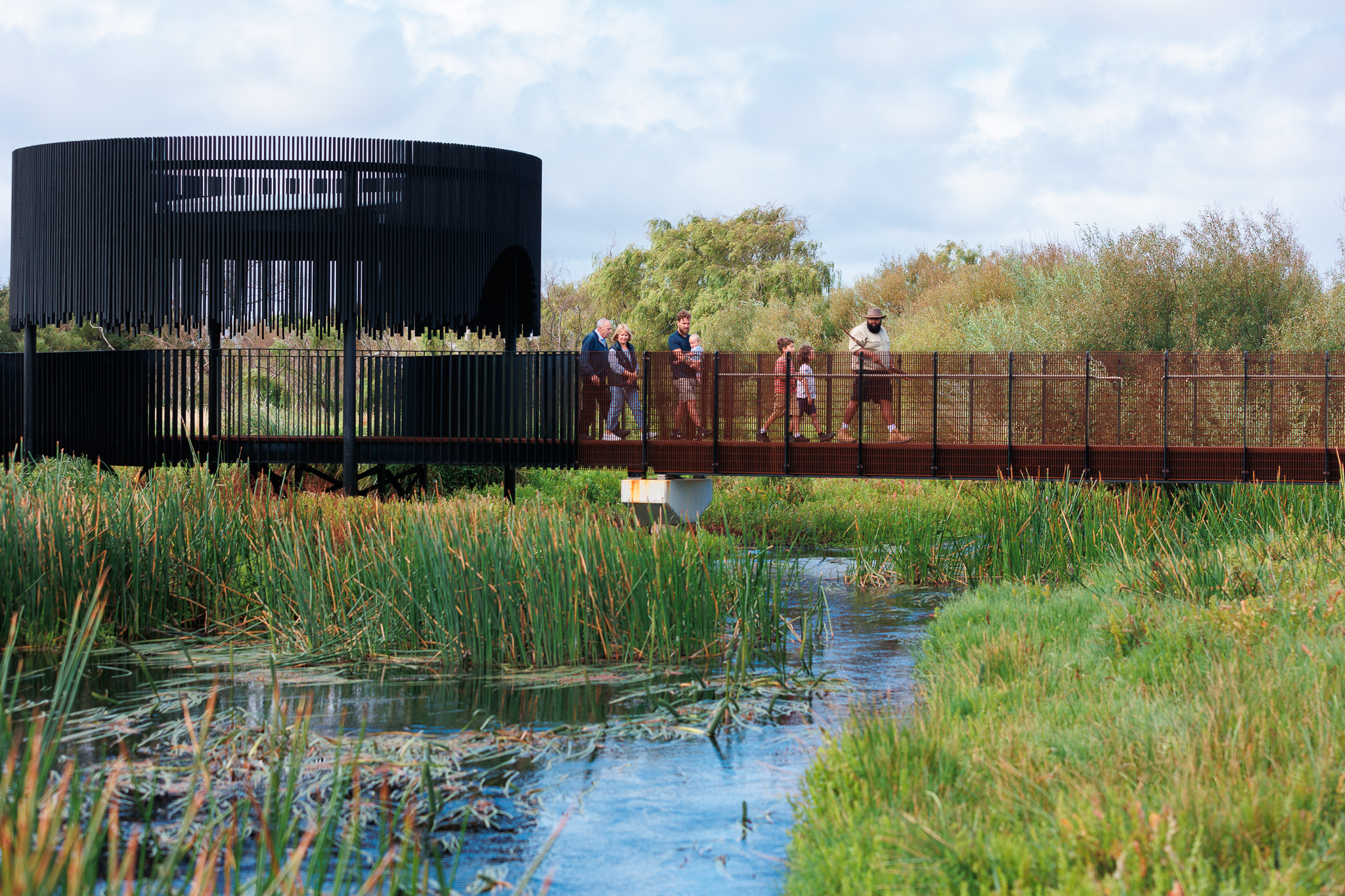
- Raised pathways and boardwalks
- Multi-level interpretations system within the site at key visitor locations
- Recreated stone houses
- Stone aquaculture sites
- Seasonal wetlands
- Indigenous plants
Visitor Guide
![]()
![]()
![]()
![]()
![]()
![]()
Features of interest inlcude the traditional housing of the Gunditjmara people, ston structures, traditional foods and eel farming.
The Winda-Mara Aboriginal Corporation manage the Tyrendarra IPA and run Budj Bim Tours at the site.
Gunditjmara Art
A creative form of expression of connection to Gunditjmara Country is evidenced in large-scale stone sculptures.
A kooyang sculpture produced from Budj Bim lava flow stone by a group of International Student Volunteers is situated within the Tyrendarra component.
Walking Trails
Walking trails at Tyrendarra allow visitors to explore features associated with two different aquaculture complexes and their wetland settings, as well as acccess the Tyrendarra interpretation trail.
Visitor Update
Construction of new infrastructure across five Budj Bim locations commenced in December 2020.

Other Cultural Sites

Kurtonitj
A beautiful 353 hectare marshland halfway between Victoria's Budj Bim volcanic plain and the ocean.

Tae Rak (Lake Condah)
1,700 hectares of significant wetlands and stony rises right next to the historic lava flows of Budj Bim volcano.
